Open desert. Long horizons. Transitional frontier.
WESTERN SAHARA
ASIA
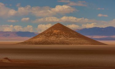
Western Sahara forms the vast desert corridor between Morocco and Mauritania. Overex travels through this region as part of larger Saharan expeditions, where distance, isolation, and exposure define the journey. This is a landscape of scale rather than variation — a passage across open terrain.
W. SAHARA
Vast open desert corridor with minimal settlement
WESTERN SAHARA
TRAVEL SNAPSHOT
ASIA
TERRITORRY
WESTERN SAHARA
- • REGION: North-West Africa
- • ADMINISTRATIVE CONTROL: Disputed territory (administered largely by Morocco)
- • LANDSCAPE: Coastal desert plains, gravel expanses, Atlantic shoreline
- • ALTITUDE RANGE: Sea level – approx. 463 m
- • CLIMATE: Arid desert — strong coastal winds
- • POPULATION DENSITY: Extremely low
- • OFFICIAL LANGUAGE(S): Arabic / Amazigh (Berber)
- • LOCAL CURRENCY: Moroccan Dirham (commonly used)
EXPEDITION PROFILE
WESTERN SAHARA
- • BEST SEASON: October – April
- • REMOTENESS: High
- • DRIVING CONDITIONS: Long-distance paved stretches, desert tracks in sections
- • PACE OF TRAVEL: Steady long-haul movement
- • TRAVEL STYLE: Expeditions (Transit corridor)
- • DIFFICULTY: Moderate (distance & exposure based)
- • LOCAL INTERACTION LEVEL: Low
- • ELECTRICITY: 220V
Antarctic Peninsula
Duration
11 Days
Difficulty
Accessible
OVEREX LATITUDE SERIES 2026 PARAMARIBO → IQUIQUE
Duration
50 Days
Difficulty
Demanding
EXPEDITION CONTEXT
• Strategic corridor linking North Africa to West Africa
• Former trans-Saharan and coastal trade routes
• Atlantic-facing desert systems
• Limited urban concentration outside key towns
FIELD NOTES
• Long fuel gaps between settlements
• Security checkpoints along main corridor
• Strong coastal crosswinds
• Limited services outside main transit towns
• Border crossing into Mauritania requires preparation

